Enhanced and soon to be available on your Smart Phone or I Pad for
FREE!

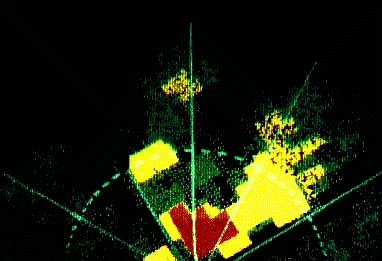
So are mountains!

![]()
|
|
|
|
![]()
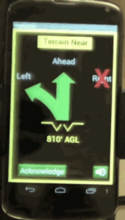
Virtual Simulation of
|
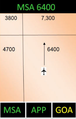
The Enhanced version of AMSADD AMSADD on your smart phone or i Pad now gives you
constant MSA information. Approach monitoring down to minimums is
under development The Minimum Safe Altitude is constantly displayed at the top for immediate reference. The "Two Minute" arrow clearly indicates where you will be in two minutes based on your ground speed and ground track. The "MSA" icon button on the lower left side allows the MSA to be selected and displayed after leaving the airport area. Under Development for APP and GOA. The "APP" (Approach) button allows constant monitoring of your approach regardless of ILS, GPS, VOR, ADF, LOC only, and visual approach. The "GOA" (Go Around) icon button will immediately indicate the missed approach procedure and verbally "talk" you through the procedure, step by step, similar to getting directions on your smart phone.
All this for no charge download! Continental U.S., Alaska and Hawaii now. Free to download. Try it, fly it. How's that for competition! Easy to include with your other aviation
|
Three blundering statements made in the past.From a noted physicist in 1910: "If man flies faster than 500 MPH, the body will disintegrate."From the President of IBM in the 60's: "No one will ever want a computer in their home."From one Terrain Warning manufacturer. "The CFIT problem has been solved."FACTS:
|